Falcon 4 Airbase Leveling Tutorial
Falcon 4.0 Forum, Falcon 4 Home, Falcon 4 Campaign, Falcon 4 Cockpits, Falcon 4 Database, Falcon 4 File Formats, Falcon 4 SRTM Terrain, Falcon 4 Terrain, Falcon 4 Textures, Falcon 4 Tools
Does your theater's airbases have the nasty “Stairs Effect” that breaks the runway/taxiways apart? Well read on, this tutorial is just for you.
This tutorial hopefully guides you to understand how the airbase leveling is handled. It shows you to correctly use TVConverter (TVC) to find correct locations on the terrains.
Lets begin. First open TerrainView, load your theater.L2 file and airport features as shown in the figure 1. This should be familiar to you by now if you have read our Falcon 4 Tiling Tutorial.
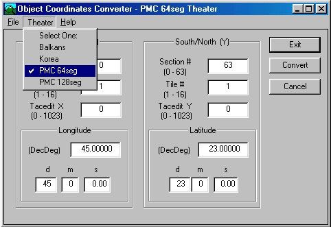
Next open TheaterMaker → TVConverter → Select theater so we got correct numbers running. First you need to configure the TheaterMaker.ini file to include your theater, but generally if you DONT use long/lat numbers at all you can do just like I did, a generic 64 segment and 128 segment theater selections. And if you arent never going to use 128 theaters there is no point making one available on the .ini file, so if no 128's and long/lat's are needed then just use the default korea or balkans, it does not matter.
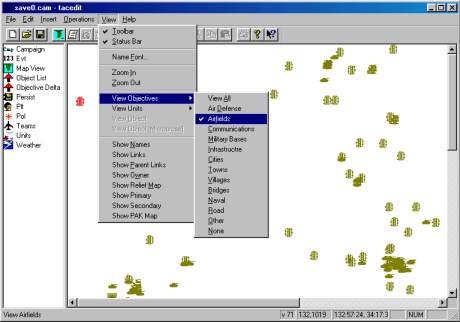
Next step is to open Tacedit and your current .tac or .cam your working on. In View menu select only airfields to be visible (helps a lot, clears the screen clutter) as shown in figure 3.
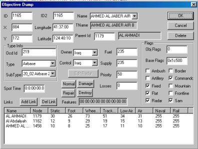
Now double-click the airbase you want to level and you will see the objective dump (figure 4), check out the X and Y coordinates. In our example we wanted to level the Kuwaiti airbase called AHMED AL JABER AIR BASE which is on the coordinates X: 884 Y: 172
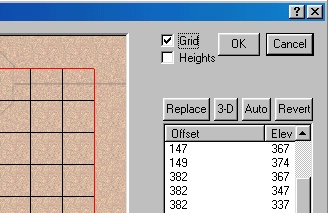
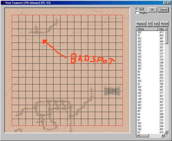
Type these numbers to TVConverter slot Tacedit X and Tacedit Y. now TVC tells you the terrainview segment is 55,53. Open tv 55,53 segment and click Grid to get better grid view (fig 5).
TVC shows the location of X tile 5 and Y tile 13. The X 0, Y 0 tile in the segment view is Lower Left. So we count 5 tiles to the right and 13 tiles up from lower left. There we will find a pretty bad spot for airbase tiles because of the road and river (fig 6).
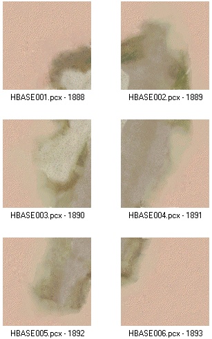
The excat location of the airbase from TVC coordinates is middle-left. Ok what the heck is “middle left” you ask… well as the airbase tilet-set's are consists of 6 tiles, vertical row two tiles side by side. So we have two tiles up, two tiles down and from the middle tiles the left one is the center marking point of TVC coordinates. Umm this is kind of hard to explain. From this next image you can see what I mean.
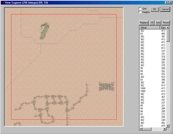
So here, two rows vertical for three tiles, two tiles side by side. In this desert airbase background tile example the hbase003.pcx - offset 1890 would be the TVC coordination tile… “Middle-left” :) Also you need to make a note that there are lot of airbase types. some have three tiles horizontal and two vertical… ok lets get back to work. Here is the location for our TVC coordinates in the terrain, yes a bad spot.ok we gotta move it (its not so nitty picky here) and tile the terrain a bit. I have always kept rivers less than important (heh), so that smallish river slid must go. we moved airbase one tile upwards (fig 7).
Now tile the airbase background tiles. in our example we used the 20_02 airbase 2 type so we tiled to correct tiles (you need to check out the tiles matching different types of airbase yourself).
Now that the airbase tiles are laid out, you gotta level the terrain so we do not encounter “stairs effect” when taxiing the airbase. click the Heights tick on (fig 5). check out the highest elevation of that airbase tile region (region is about one tile all around BEYOND the 6 airbase tiles, surrounding area). in our case it was 413 (fig 8).
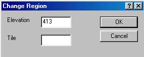
now right mouse click and drag a box around ALL of the tiles within airbase and surrounding area, you will get dialog asking elevation and tile. insert 413 to the elevation but leave the tile empty. now click ok and voila, all elevations changed! (fig 10).
Now we need to update the new airbase location. enter the new Y coordinate of 14 into the TVC which now tells you the new Tacedit Y coordinate to be 173.
Adjust tacedit Y coordinate to 173.
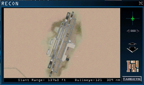
Thats it, you are done editing the TE/Campaign and theater.L2 files. Now just run Tinstall to rebuild the terrain so your newly edit changes will take effect in the sim itself. Start up falcon and check out recon for the airbase you edited, no stairs effect and it should look something like this:
Done!

