This is an old revision of the document!
Table of Contents
Real World Data Acquisition Using Global Mapper
How to get terrain heightmap and satellite texture into Terrain Builder using Global Mapper. www.globalmapper.com
This page is created with Global Mapper v18.0 b101416 (but we also have short v13 info).
Terrain ASCII Grid
How to use Global Mapper to create real world data terrain for arma3.
This ASCII Grid ASC tutorial assumes you have downloaded heightmap from opentopo.sdsc.edu website, further instructions check out QGIS Real World Data: Terrain Heightmap tutorial.
Terrain:
- start global mapper
- open data files → select your ASC
- tools → configure → projection, select projection dropdown UTM, zone 31, apply and ok
- select digitizer tool button (or press ALT-D)
- in your terrain hit RMB → advanced feature creation options → create regular grid of user-specified size/orientation
- LMB click on terrain
- grid setup dialog, put grid cell width and heigth to what size of terrain you want to create, lets say 20480, click ok
- now you can move the grid, CTRL-SHIFT-M, then drag the grid to move
- make sure the grid is selected, then file → export → elevation grid format, arc ascii grid, ok
- arc ascii grid export options dialog, sample spacing put both x/y axis to 10 meters
- select export bounds tab
- tick crop to selected area feature(s) box and click ok
- give file name to your exported asc, click save
- open asc in text editor, change xllcorner to 200000 and yllcorner to 0 and save the asc
- start terrain builder and import asc
all done
Global Mapper v18 Digitizer Tool RMB menu:

Global Mapper v18 Export Menu menu:

Global Mapper v18 Digitizer Tool RMB Advanced Feature Creation:

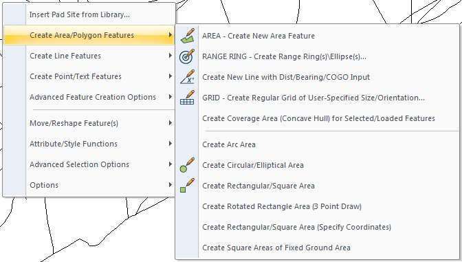
Global Mapper v18 Digitizer Tool RMB Create Area/Polygon Features:
Satellite Texture World Imagery
We use online map sources, world imagery, to download satellite texture.
Satellite texture:
- click globe button (connect to online data)
- choose world imagery, click connect
- file → export → export raster/image format, choose bmp, click ok
- sample spacing put both x/y axis to 1 meters
- select export bounds tab
- tick crop to selected area feature(s) box and click ok
- choose file name like satellite_texture_lco.bmp and click save
all done
ASTER GDEM Heightmap
- Start global mapper
- click globe button (connect to online data)
- select aster gdem and hit connect
- click globe button (connect to online data)
- select world street map
- use zoom button (ALT-Z) and select the area where you want to zoom in
- select digitizer tool button (or press ALT-D)
- in your terrain hit RMB → advanced feature creation options → create regular grid of user-specified size/orientation
- LMB click on terrain
- grid setup dialog, put grid cell width and heigth to what size of terrain you want to create, lets say 20480, click ok
- now you can move the grid, CTRL-SHIFT-M, then drag the grid to move
- make sure the grid is selected, then file → export → elevation grid format, arc ascii grid, ok
- arc ascii grid export options dialog, sample spacing put both x/y axis to 10 meters
- select export bounds tab
- tick crop to selected area feature(s) box and click ok
- give file name to your exported asc, click save
World Imagery Satellite Texture
- click globe button (connect to online data)
- choose world imagery, click connect
- file → export → export raster/image format, choose bmp, click ok
- sample spacing put both x/y axis to 1 meters
- select export bounds tab
- tick crop to selected area feature(s) box and click ok
- choose file name like satellite_texture_lco.bmp and click save
Our attempts to export 40960 x 40960 resolution world imagery satellite texture ended up Global Mapper freezing with 0% CPU usage. We don't know if there is some specific image size which start to cause these freezes, 20480 x 20480 images seem to export fine though and most terrains out there are ok with this size.
Export Satellite as Tiles
If you are exporting very large satellite texture, its good idea to split it up for smaller tiles. This is usually done by 2 x 2 but could be done as 4 x 4 tiles too, however in our example we use 2 x 2 tiles.
This assumes you have read world imagery satellite texture part so you know how to export satellite image.
- on bmp export options dialog, select tiling tab
- tick “specify number of rows and columns”
- put both rows and columns to value 2
As mentioned you could also use 4 x 4 so type in value 4 then.
After you've chosen the tile setup, continue exporting from export bounds tab.
With 2 x 2 setup the tile names are as following:
A1 top left
A2 top right
B1 bottom left
B2 bottom right
v13 Roads Shapefile Crop
How to crop / clip your roads shapefile in Global Mapper v13 b121011 by M1lkm8n
- digitizer tool → RMB → create area shapes → create rectangular/square area (specify coordiantes)
- tick “corner w/size - global projection (UTM - meters)
- type in width and height <your terrain size>, click ok and ok
- file → export vector format → shapefile from dropdown
- shapefile export options, tick export lines, type in roads.shp file name, click save
- select export bounds tab
- tick crop to selected area feature(s), click ok
Terra Incognita Satellite Texture
Satellite texture Terra Incognita explains how to download satellite texture in oziexplorer .map format which can be opened in Global Mapper.
Finding Location On Globe
Go to maps.google.com and navigate to the place which interests you.
RMB position → whats here? → click the link that popped up bottom center of browser. Now the coordinates appear in the navigation bar on left side of the browser with coordinates of this location, from there its easy to copy paste them to your text notes.
You can also use Global Mapper → Connect to Online data (Online Sources) → World street map, to open street maps which show you locations in countries just like maps.google would. However maps.google is much faster / optimized and has some search plus additional features.