This is an old revision of the document!
Table of Contents
QGIS Real World Data Tutorial
ArmA 3 QGIS Real World Data Tutorial By Ross
This process has often been described using Global Mapper, but I wanted to detail the equivalent steps within the open source (free) GIS app - QGIS.
The goal was to achieve an export satellite image and heightmap with the same or better quality than would be possible with Global Mapper.
I've used GDAL command lines where possible, which simplifies the process a little, and reduced additional processing on the data.
The following software versions were used for this tutorial:
I have referenced Terra Incognita because i felt it was the easiest way to obtain satellite data in the oziexplorer map format - see this tutorial for help using Terra Incognita.
First an overview of the steps required:
For Heightmap:
- Load heightmap into QGIS (drag and drop)
- Set QGIS to appropriate CRS for location of your HM
- Create shapefile & generate perfect square using Advanced Digitizing panel
- Obtain extents from square feature
- Run 2 GDAL commands
- First to set cell size, CRS and then clip to shapefile square extents
- Second to convert to .asc file
For Satellite image
For single tile export
- Load in just the '.map' files generated from Terra Incognita into QGIS
- Merge rasters
- Obtain extents from square feature
- gdalwarp command will set cell size, CRS and then clip to shapefile square extents
For 4 tile export (large projects 40960 and above)
- Load in just the '.map' files generated from Terra Incognita into QGIS
- Merge Rasters
- Create grid – 2 x 2 Feature
- Move each quarter to its own shapefile layer
- Obtain extents from each quarter feature
- Run gdalwarp command for each quarter to set cell size and CRS and clip to shapefile square extents
And now detailed steps for:
Heightmap:
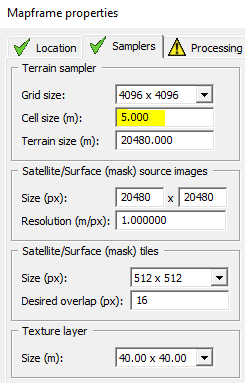
This tutorial covers single raster heightmap as per the kind you will find on opentopo here, I will detail steps for heightmaps spread across muliptle rasters in another update. as they will require additional steps likely including Merge / Build Virtual Raster commands. This section does not cover any re scaling of heightmap, which I would recommend against anyway. Remember Grid size x Cell size should = the same size (meters) as your source heightmap selection.
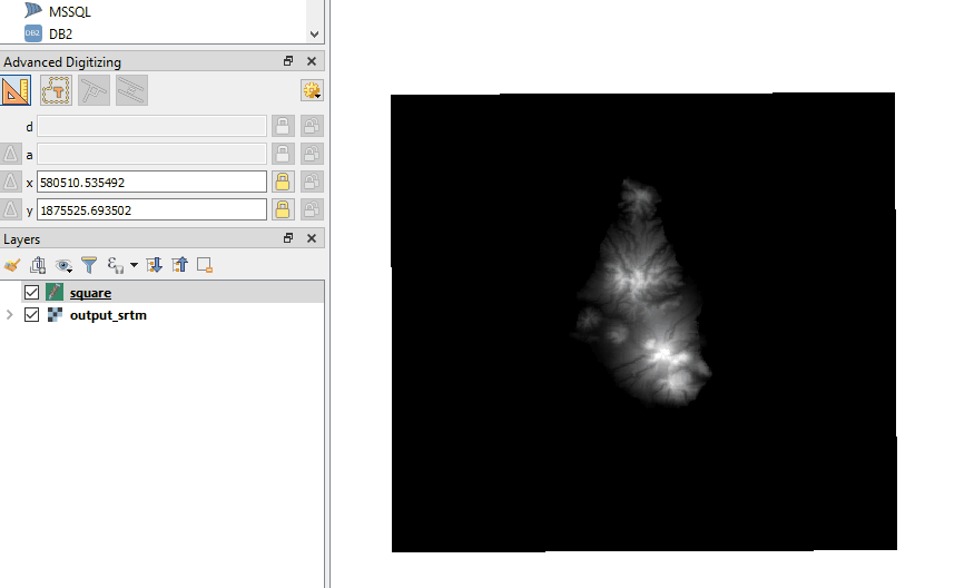
Drag and drop your heightmap '.asc' into QGIS
If you do use opentopo for source of Heightmap, make sure extract both the .asc and .prj files before proceeding with below. They should both be in the zip file from opentopo.
Set QGIS to appropriate CRS for location of your HM
Clicking on the CRS section bottom right within QGIS – will bring up the Project Properties for CRS

Select the CRS to match your real world data, in this example its ‘WGS 84 UTM zone 20N’ because the terrain is from the Montserrat in the Caribbean. See also UTM projection.
This will ensure your QGIS project space works appropriately with any other data you want to add - eg road shapefiles etc. Terrain Builder will only use UTM 31N but we'll get to that later.

Create shapefile & generate square feature using Advanced Digitizing panel
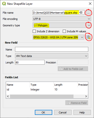
Top menu – Layer > Create Layer > New Shapefile Layer
Save to project folder location
Change Geometry type to ‘Polygon’
Match CRS so it is the same as that just configured in above step
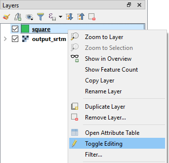
Right click on your shapefile in layers window & select ‘Toggle Editing’
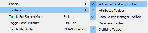
From menu – View → Toolbars → Advanced Digitizing Toolbar
Select ‘Add Polygon Feature’
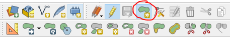
Select Enable advanced digitizing tools

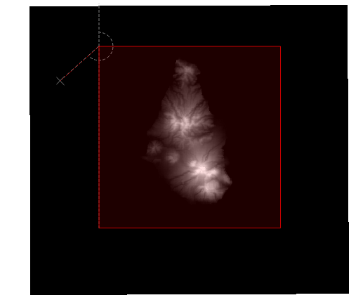
To create a perfect square, left mouse click for your top left starting point, move your mouse to the right a little, then press ‘d’ on keyboard, type in the exact width (distance) required (in this example ‘20480’) then immediately press Enter – be careful not to move the mouse before pressing Enter or it will mess up the number. Press left mouse click and you will have drawn your first horizontal line which turns red. By default this tool snaps to 90 degree angles, making it easy to draw your lines. Now to draw the vertical line start moving mouse your down, press ‘d’ again and type in same figure as above, press Enter and another left mouse click, repeat the process for the last 2 lines of the square.

See a short video example using the Advanced Digitizing tool:
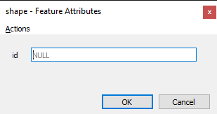
After the last left mouse click from the step above, the tool is still waiting to plot more points, so to finalise the square do a right mouse click
This will then bring up an attributes dialogue – just type any number and Enter
Save the above edits to the shapefile by clicking on the layer & selecting ‘Toggle Editing’
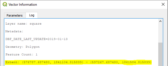
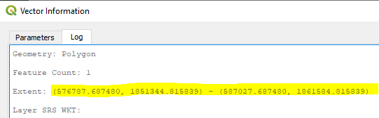
Obtain extents from square feature
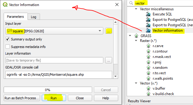
Activate the toolbox if it is not already available

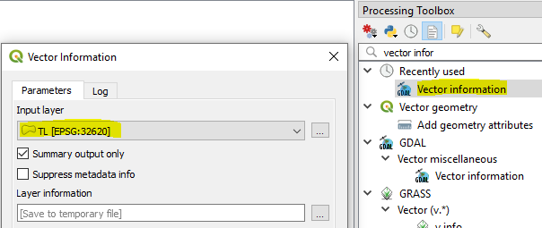
Start typing 'vector' in Processing Toolbox search bar, and you will see 'Vector information'
Double click it and make sure your square input layer is selected - then just click Run
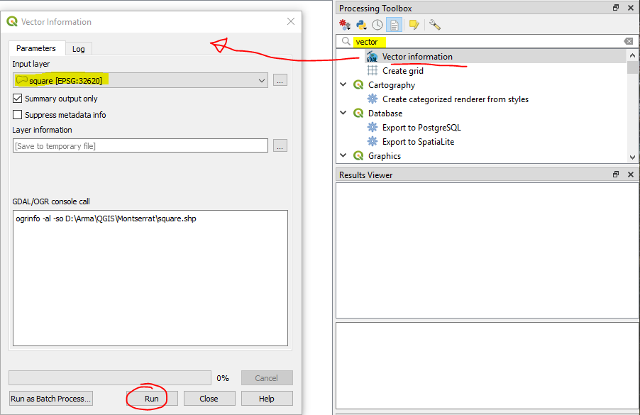
You will only need to copy the Extent figures, which we will use within the GDAL commands in the next step
Run the first GDAL command which will - set CRS, cell size and then clip to shapefile square extents
From menu - Plugins > Python Console
Click 'Show Editor'

The blank window on the right is where you will paste GDAL commands
Now you are ready to edit the command below to match your data - sections in bold are the parts to edit:
import os
os.system(r'''gdalwarp -t_srs EPSG:32620 -wo SOURCE_EXTRA=1000 -tr 5.0 5.0 -srcnodata “-9999” -r cubic -of GTiff -te 576787.687480 1841104.815839 597267.687480 1861584.815839 D:/Arma/Heightmaps/Opentopo/output_srtm.asc D:/Arma/QGIS/Montserrat/converted.tif''')
Some explanation of the key parameters:
-t_srs EPSG:32620
CRS to match where the heightmap is from in the world.
-tr 5.0 5.0
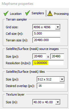
The desired resolution of your heightmap, match with Cell size set within your Mapframe properties in Terrain Builder:
-te 576787.687480 1841104.815839 597267.687480 1861584.815839
The 4 long figures represent the extents of your square, and should be replaced with your own figures obtained in previous step.
Update the paths to match where you are storing your source heightmap, and where you want the output tif saved to.
Input:
D:/Arma/Heightmaps/Opentopo/output_srtm.asc use double quotes around your input path if it contains any blanks
Output:
D:/Arma/QGIS/Montserrat/converted.tif
Run second GDAL command - converting tif from above step to a Terrain Builder friendly .asc
Remember to change the paths in below command to match where your files are located
import os
os.system(r'''gdal_translate -of AAIGrid D:/Arma/QGIS/Montserrat/converted.tif D:/Arma/QGIS/Montserrat/final.asc''')
Satellite image
For single tile export
Load in just the '.map' files generated from Terra incognita into QGIS
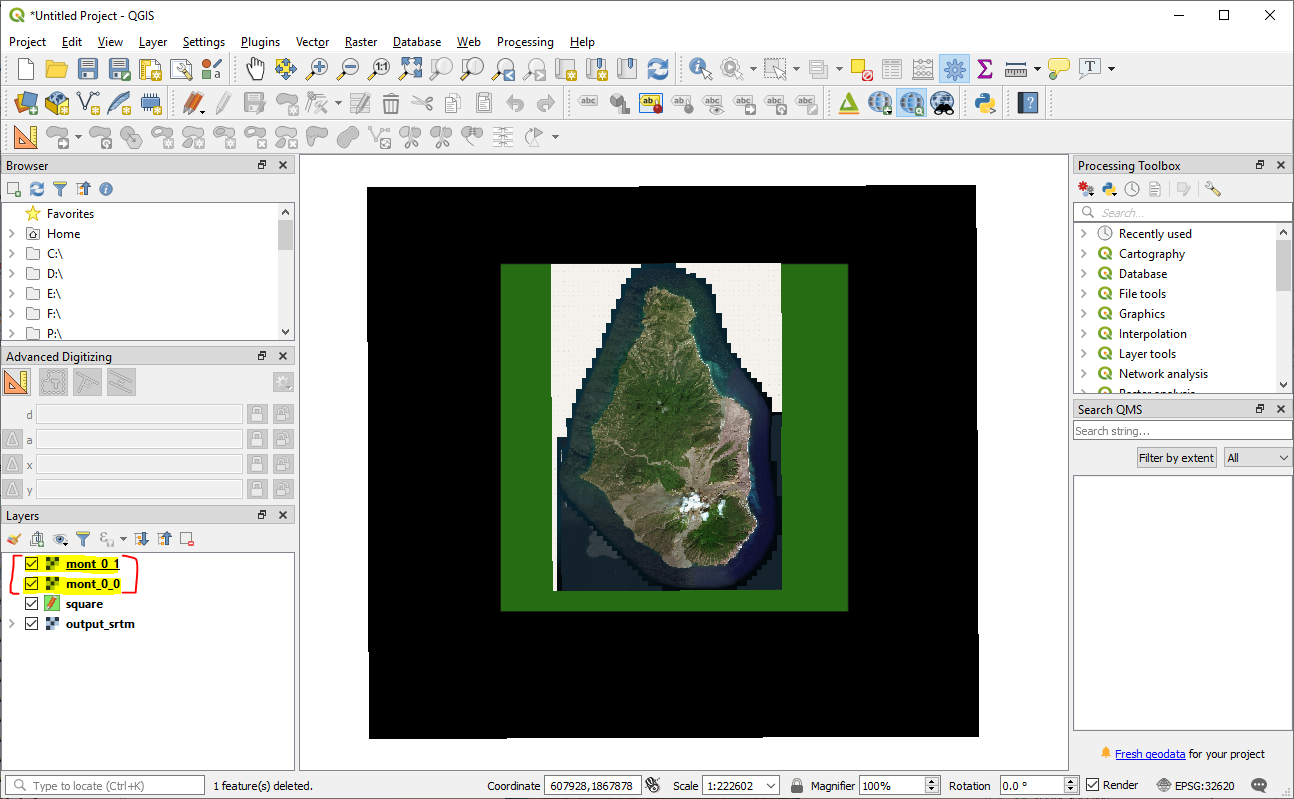
Merge Rasters
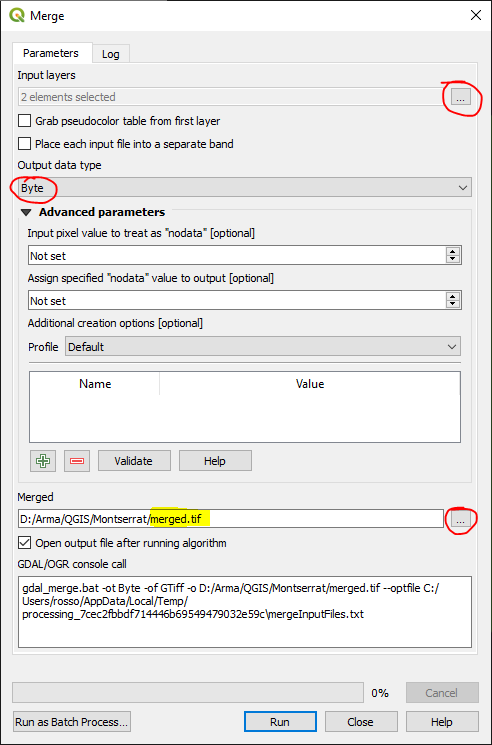
Top Menu - Raster → Miscellaneous → Merge
Select all your .map files as input layers

change Output data type to ‘Byte’ as the default is ‘Float32’.
Select ‘Save to File’ under Merged – as the default is to a temporary file.
Obtain extents from square feature
You should already have this from working on heightmap above 576787.687480 1841104.815839 597267.687480 1861584.815839
Run GDAL command
import os
os.system(r'''gdalwarp -t_srs EPSG:32620 -r cubic -wo SOURCE_EXTRA=1000 -tr 1.0 1.0 -r cubic -of BMP -te 576787.687480 1841104.815839 597267.687480 1861584.815839 D:/Arma/QGIS/Montserrat/merged.tif D:/Arma/QGIS/Montserrat/mont.bmp''')
Some explanation of the key parameters:
-t_srs EPSG:32620
Sets the CRS
-tr 1.0 1.0
Sets the resolution of your satellite image to 1mtr per pixel - which is recommended. Make sure it matches your settings within Terrain Builder.
-te 576787.687480 1841104.815839 597267.687480 1861584.815839
Clips to shapefile square extents
For 4 tile export
Detailing additional steps required for a 4 tile export – which would suit those terrains that are 40960px x 40960px and higher.
Load in just the .map files into QGIS
Merge rasters - same as above (single tile export)
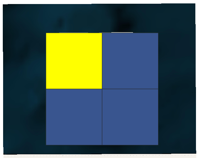
Create grid – 2 x 2 Feature
You will need to have created the square shapefile first – see above steps
Top Menu – View → Panels → Processing Toolbox
Processing Toolbox Menu – Vector Creation > Create Grid
Set Grid type to ‘Rectangle (polygon)’ & the Horizontal & Vertical to half the distance of your main square
Set it to save new grid feature to .shp file
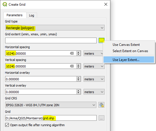
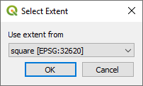
After clicking 'Use Layer Extent' Select the shapefile layer for your square
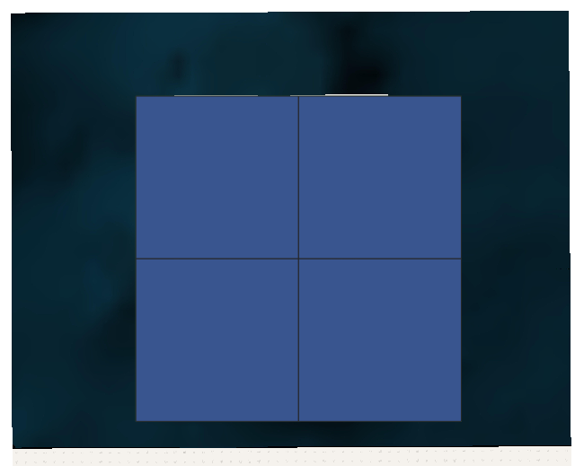
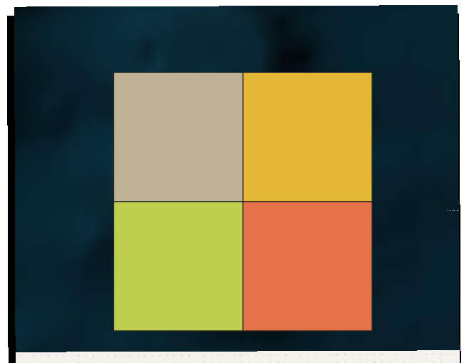
After clicking Run, your original square will then be Covered with a new grid of 4 tiles – perfect quarters of your original square
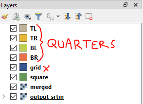
Move each quarter to its own shapefile layer
Because you will need to export each quarter separately for use in Terrain Builder, we will move each quarter onto its own shapefile layer.
Click Select Features -

And select the first quarter:
Top Menu – Edit > Copy Features
Then… Edit → Paste Features As → New Vector Layer
Save shapefile layer to something obvious
I’ve used ‘TL’ for top left.

Repeat for the remaining quarters and you’ll have something like below, ‘Grid’ can be deleted.
You will then have 4 tiles which we can use to gather each quarters extents
Obtain extents from each quarter feature
Copy extents to clipboard
And list them out for safe keeping -
TL - Extent: (576787.687480, 1851344.815839) - (587027.687480, 1861584.815839)
TR - Extent: (587027.687480, 1851344.815839) - (597267.687480, 1861584.815839)
BL - Extent: (576787.687480, 1841104.815839) - (587027.687480, 1851344.815839)
BR - Extent: (587027.687480, 1841104.815839) - (597267.687480, 1851344.815839)
Run GDAL command for each quarter to set cell size and CRS and clip to shapefile square extents
import os
os.system(r'''gdalwarp -t_srs EPSG:32620 -r cubic -wo SOURCE_EXTRA=1000 -tr 1.0 1.0 -r cubic -of BMP -te 576787.687480 1841104.815839 597267.687480 1861584.815839 D:/Arma/QGIS/Montserrat/merged.tif D:/Arma/QGIS/Montserrat/TR.bmp''')
Loading your assets into Terrain Builder
I would recommend saving copies of any files to be used in Terrain Builder into a separate terrain project folder. This will prevent your source project files being adversely affected, and potentially no longer working within QGIS - particularly relevant to those changes mentioned below.
Heightmap (.asc) edits
Open your asc in notepad and change the following to ensure it loads in Terrain builder:
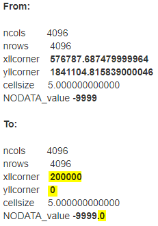
Save to a new asc, whilst maintaining the original for use in your QGIS project space
Before loading the asc file into Terrain Builder, delete the .prj file. Otherwise it will not import into TB.
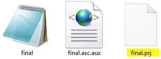
Satellite image
Before loading the satellite image into Terrrain Builder delete the .bmp.aux file

Managing the project assets within QGIS
Save your QGIS project so that you can return to export further data at a later date.
Layers can be tidied up to hold the essentials ready for the next time you want to re-run GDAL commands, or export anything else like road shapefiles or mask layers etc.
Preparing Road Shapefile
Load into QGIS (drag and drop) road shapefile
In this example I got a good dataset from - https://data.humdata.org/
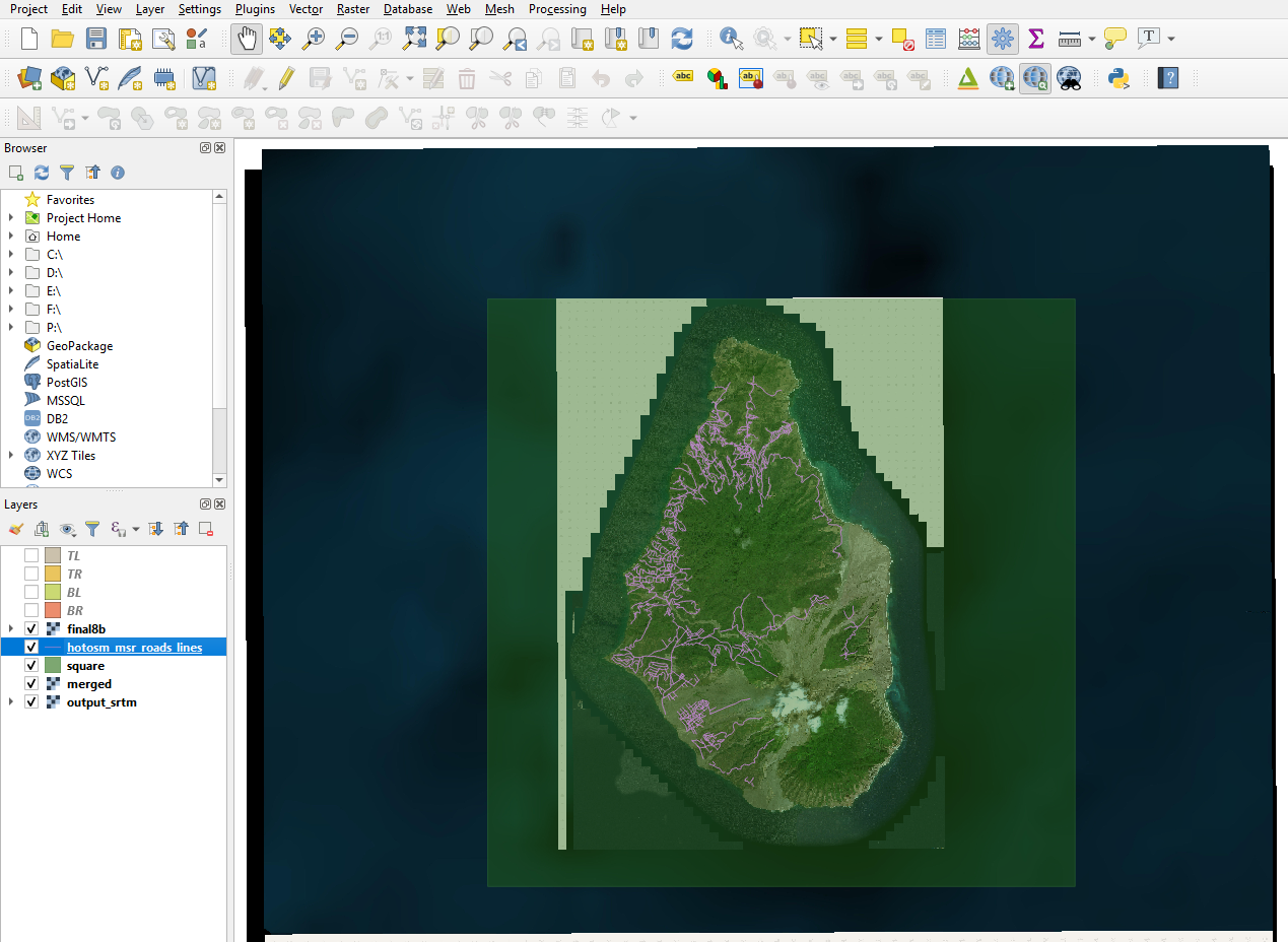
Clip vector to square shape Top Menu - Vector > Geoprocessing Tools > Clip
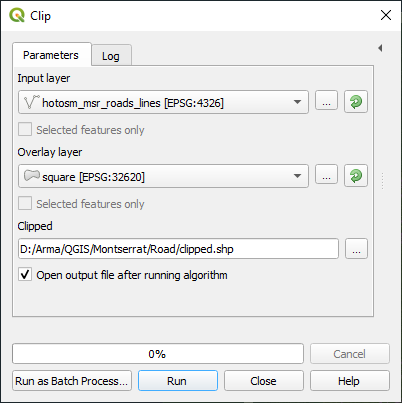
Save features from clip to new shapefile - selecting appropriate CRS, in this example CRS UTM-20
Top Menu - Layer > Save As

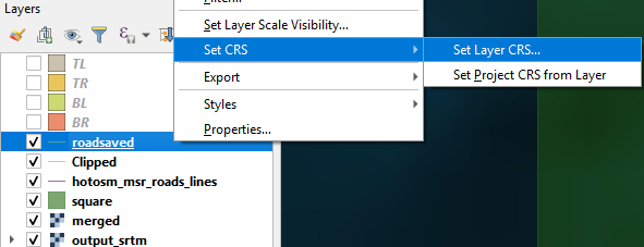
Set road shapefile to CRS - 31N
RMB on road shapefile > Set CRS > Set Layer CRS
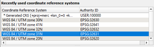
Set QGIS project CRS to UTM- 31N (bottom right corner):

Collect extents from your square shapefile:
Extent: (576787.687480, 1841104.815839) - (597267.687480, 1861584.815839)
The first two values will be used in the v.transform step below.
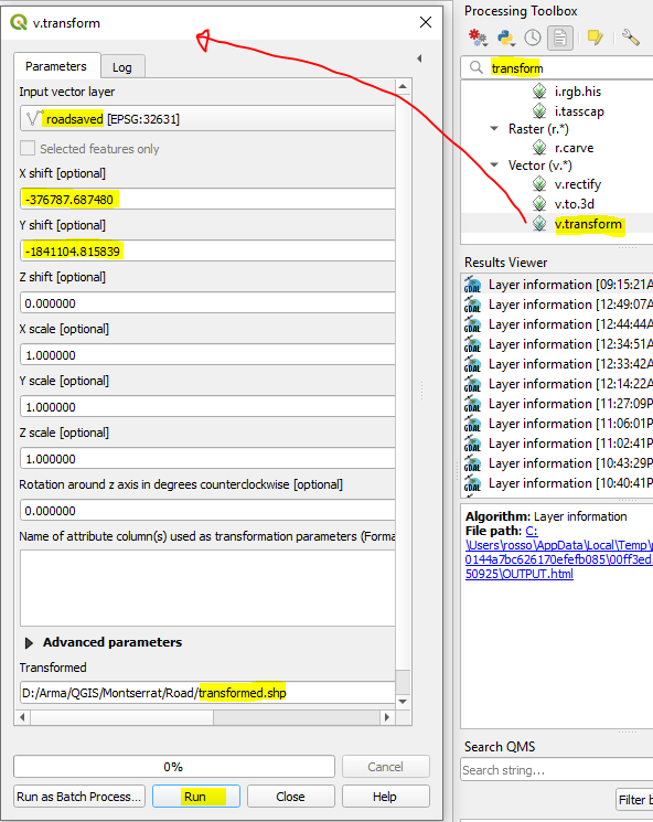
v.transform on road shapefile using calculated extents from square shapefile
Your heightmap asc must adhere to Terrain Builders required values of easting 200000 and northing 0 Your road shapefile also needs to line up to the same values - we will use v.transform to achieve this
So taking the extent values we grabbed in previous step -
We will do the following calculations to bring these values to (200000 and 0):
Easting: 576787.687480 - 376787.68748 = 200000
Northing: 1841104.815839 - 1841104.815839 = 0
-376787.68748
-1841104.815839
Having figured out the correct figures plug them into the v.transform process
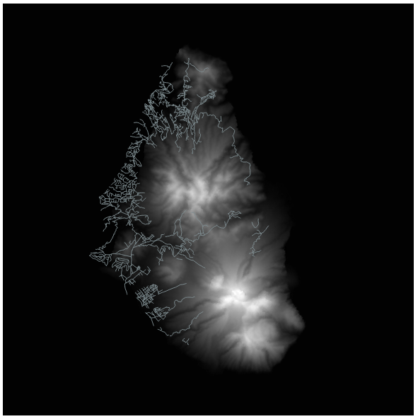
Drag and Drop into QGIS your heightmap asc - the one you are able to load into Terrain builder - already adjusted to (200000, 0)
Set CRS on above asc to UTM - 31N
Right click on asc in Layers > Zoom to Layer
In Layers panel drag the asc below your transformed road shapefile - so you can see the roads layered above the asc
Your roads should now be perfectly aligned above your heightmap
Setting ID and ORDER fields
RMB on transformed shapefile layer > Toggle Editing
RMB on transformed shapefile layer > Open Attribute Table
Click Delete field - select all fields and press OK

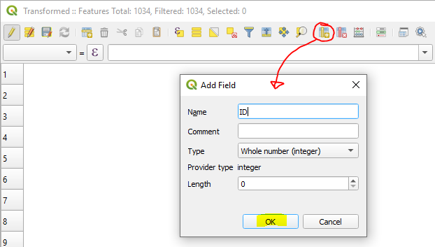
New Field - Name 'ID' - length 0
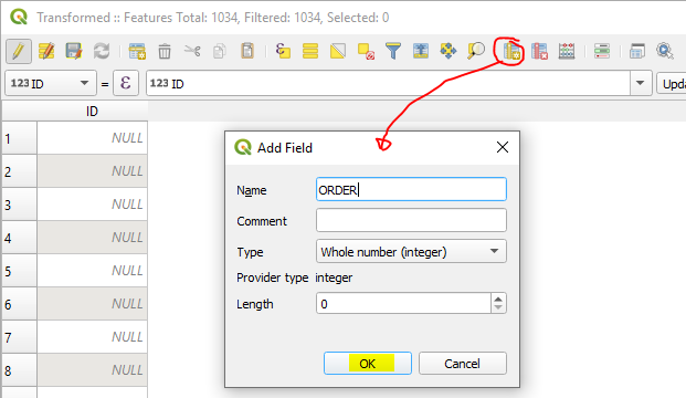
New Field - Name 'ORDER' - length 0
Toggle - Multi Edit mode
ID - Enter 0 - click Update All
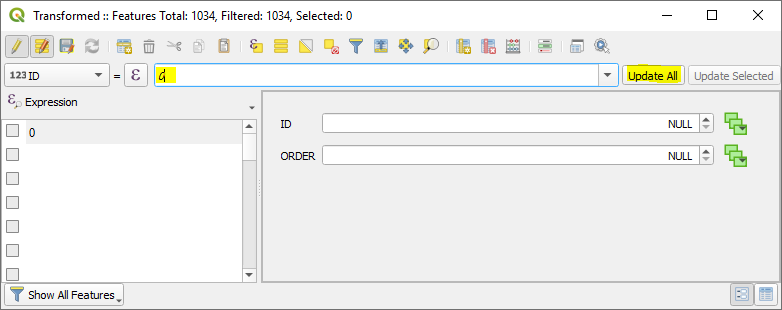
Select ORDER from drop down - Enter 1 - click Update all
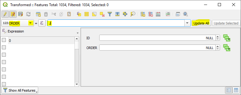
Click - Switch to table view
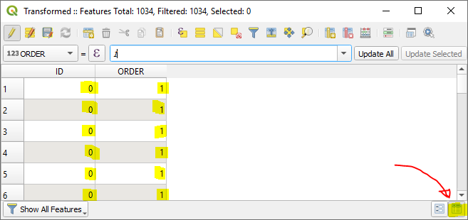
Click Save
RMB on transformed road shapefile - Toggle Editing to save the changes
Switching to Terrain Builder -
Load your road shapefile
Top menu - File > Import > Shapes
Click OK
Perfectly overlaid within Terrain builder:

3D Preview using Qgis2threejs
If you want to see an instant 3d preview of your terrain within QGIS you can with the amazing plugin Qgis2threejs
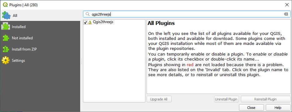
First install it:
Top menu > Plugins > Manage and Install Plugins
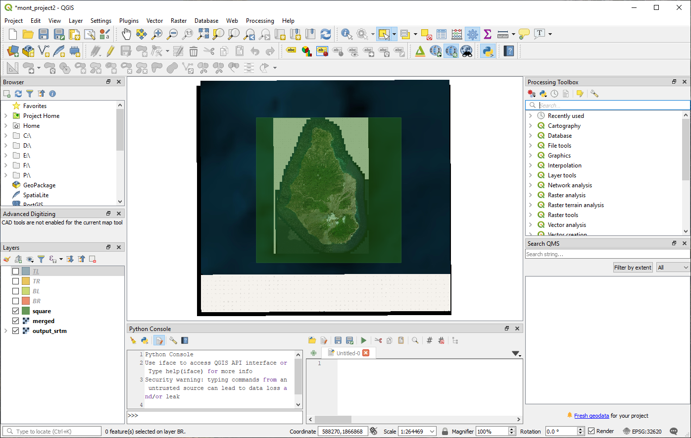
RMB on the Merged layer and select Zoom to Layer
Then select both the Merged raster, and the original source heightmap - deselect all other layers

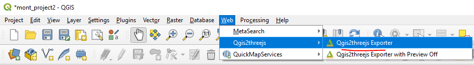
Start the Qgis2threejs plugin - Top Menu > Web > Qgis2threejs > Qgis2threejs Exporter
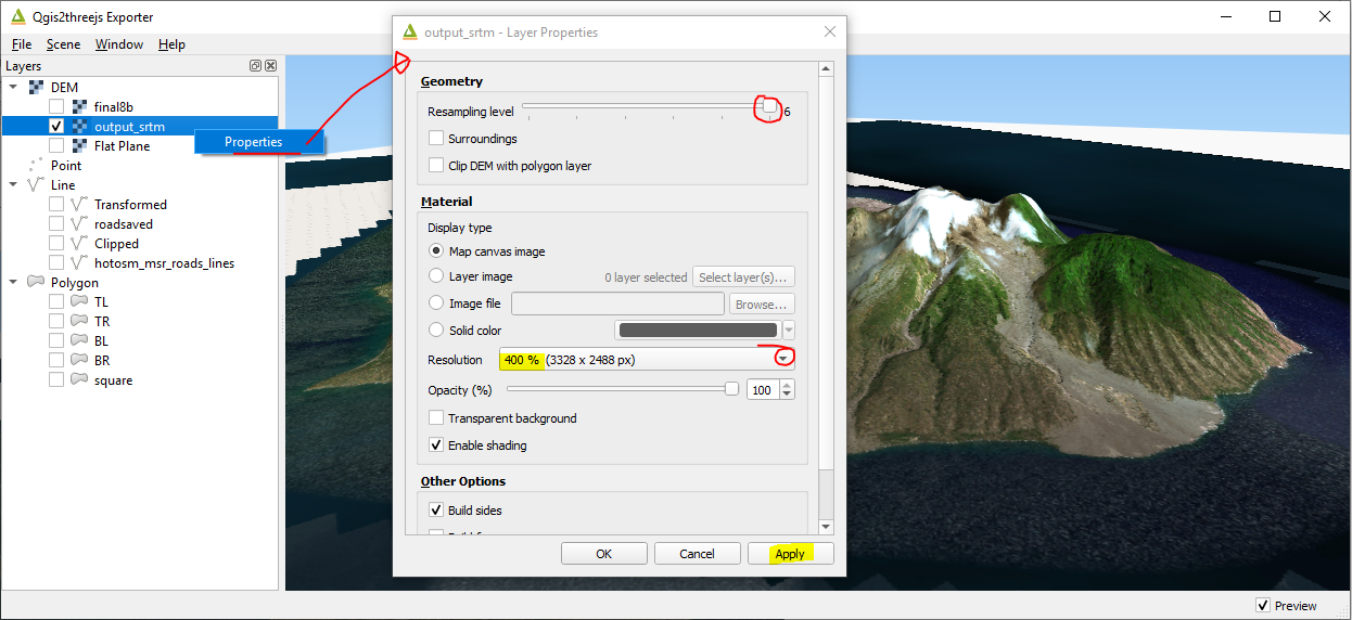
Select source heightmap and nothing else
RMB on heightmap > Properties
Set the Resampling level to 6
Set Resolution to 400%
Enjoy browsing around your terrain in 3D:
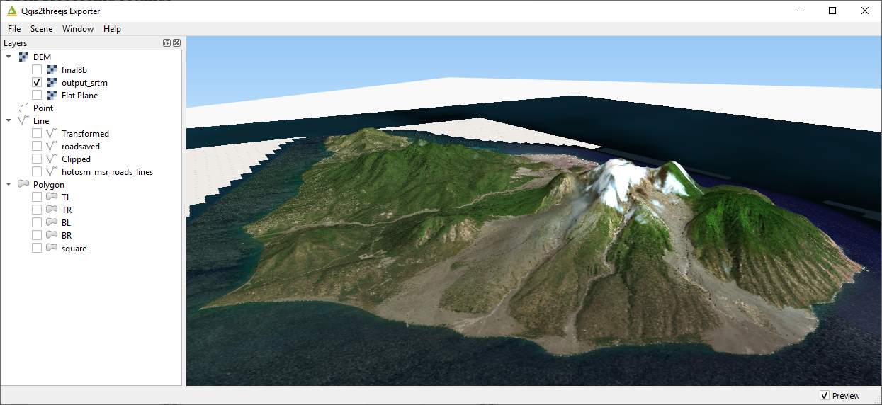
You can also export your terrain to a browser interface if you want - File > Export to web
Coming Soon:
- Assisted image classification - for creation of mask